The EuroSDR workshop "Data Science in NMCA"
02.06.2022

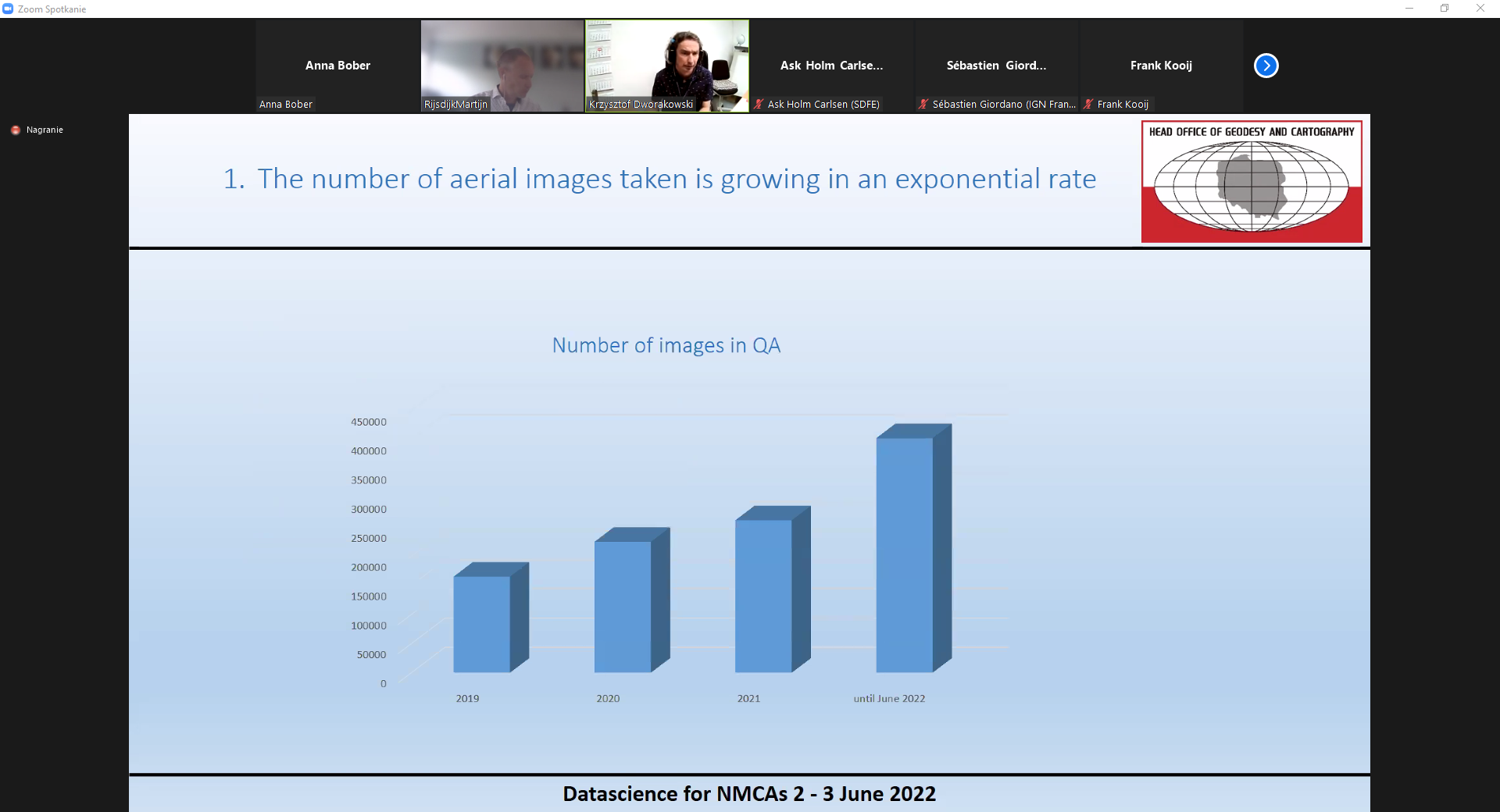
The EuroSDR workshop "Data Science in NMCA", co-organized by the Department of Geodesy, Cartography and Spatial Information Systems of GUGiK, takes place in the form of a videoconference on 2-3 June. The first day of the workshop focused on the use of AI in the processing and analysis of geospatial data, in particular image and Lidar data. Representatives of IGN from France, the University of Copenhagen, the National Land Survey from Finland and the GUGiK spoke about the challenges and experiences of implementing data science projects. During the meeting Krzysztof Dworakowski, representing the Head Office of Geodesy and Cartography(GUGiK) discussed the methodology of automatic detection of radiometric errors on aerial images by means of deep learning, which is used in the control of aerial images incorporated into the National Geodetic and Cartographic Resources.